Tropical Cyclone Horacio has strengthened into the first Category 5-equivalent storm recorded worldwide in 2026, according to the Joint Typhoon Warning Center.
In its latest advisory issued Tuesday, the Hawaii-based center reported that Horacio is producing sustained winds of 140 knots, approximately 161 mph (259 km/h), placing it at the highest classification under the National Hurricane Center’s Saffir-Simpson Hurricane Wind Scale. The cyclone is tracking south-southwest across the South Indian Ocean over open waters east of Madagascar.
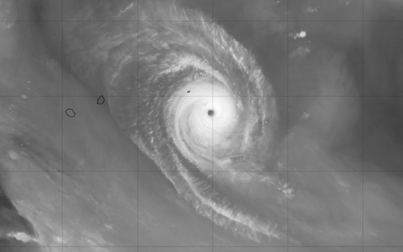
Satellite imagery shows a compact and highly symmetrical storm structure, featuring a clearly defined eye. Meteorologists said environmental conditions remain favorable for maintaining significant strength, citing warm sea surface temperatures, low vertical wind shear, and strong upper-level atmospheric outflow.
The Mauritius Meteorological Service issued a heavy swell warning at 4:30 a.m. Tuesday for Rodrigues, an outer island of the Republic of Mauritius, located roughly 350 miles east of the main island. The alert remains in effect until early Wednesday.
Forecasters warned that swells generated by Horacio are producing waves reaching up to 7 meters, or about 23 feet, beyond reef lines. Wave activity is also affecting lagoons and could break along low-lying coastal areas, particularly during high tide cycles.
Local authorities in Mauritius advised fishermen, boat operators, and residents to avoid venturing out to sea or along beaches while hazardous marine conditions continue.
At this time, Horacio remains over open waters, and no direct landfall has been reported. Meteorologists continue to monitor the system’s track and intensity as it moves through the South Indian Ocean.

Comments
No comments yet. Be the first to share your thoughts.