
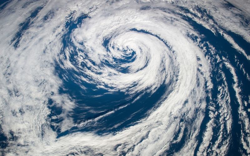
Super Typhoon Champi remains a powerful system east of the Philippines on Sunday morning as it continues its westward track across the Pacific.
As of 11 a.m. Sunday, the storm was located about 2,090 kilometers east of southeastern Luzon, outside the Philippine Area of Responsibility. It carried maximum sustained winds of 185 kilometers per hour near the center, with gusts reaching 230 kph and a central pressure of 940 hectopascals. The system moved westward at 25 kph.
State weather bureau PAGASA reported that Champi is expected to maintain super typhoon strength while entering the PAR on Tuesday morning or afternoon. It will then receive the local name Rosal. The cyclone is projected to continue west-northwestward toward Taiwan after crossing into Philippine waters.
Officials noted that wind signals could be raised over the northern and eastern portions of Northern Luzon and parts of the Bicol Region as early as Monday evening or Tuesday morning due to the storm's broad wind field. Gusty conditions are likely across much of Luzon and Visayas beginning Tuesday or Wednesday. Heavy rains are possible in extreme Northern Luzon later in the week.
The storm recently passed near Guam, delivering a close call to the island. It approached within roughly 10 to 13 miles of the southern tip as the equivalent of a Category 4 hurricane before reaching super typhoon intensity with sustained winds of 150 mph. The National Weather Service described the winds as extremely dangerous and life-threatening, with gusts up to 80 mph recorded at the airport. Power outages affected parts of the island, and several shelters reached capacity.
President Trump approved a federal emergency declaration for Guam and the Commonwealth of the Northern Mariana Islands, enabling FEMA to deploy resources and personnel. All tropical cyclone warnings for the Marianas were later canceled as the system moved away.
PAGASA emphasized that the storm is unlikely to make direct landfall on Philippine territory and will instead track over the Philippine Sea toward Taiwan. Marine warnings for rough seas are anticipated along northern and eastern seaboards starting Tuesday.
Residents in affected areas are advised to monitor updates from official sources as the forecast track and intensity could shift.

Comments
No comments yet. Be the first to share your thoughts.