
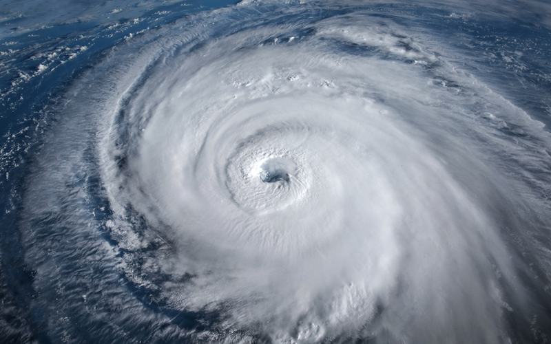
Hurricane Polo has become an unusually powerful storm after undergoing multiple periods of explosive intensification, reaching Category 5 strength three separate times this week as it moves toward the Mexican coastline.
The official Saffir-Simpson Hurricane Wind Scale ends at Category 5, which applies to hurricanes with sustained winds of at least 157 mph. But Polo's extreme strengthening has led some meteorologists to raise the hypothetical idea of a Category 6.
Gary Partyka, an atmospheric scientist with NASA's Global Modeling and Assimilation Office, described Polo's development as an exceptionally rapid intensification event.
“This was RAPID, rapid intensification,” Partyka said in comments cited by NASA.
Another meteorologist went further, saying that if a Category 6 were ever created, Polo would be an example of the kind of storm that could prompt such a discussion.
Polo's strength has been fueled in part by unusually warm Pacific waters. The hurricane traveled over areas where sea surface temperatures reached about 90 degrees Fahrenheit, while much of the surrounding region remained above 82 degrees, a temperature generally considered sufficient to support hurricane development.
Atmospheric conditions also helped the storm strengthen. Kristen Corbosiero, an atmospheric scientist at the State University of New York at Albany involved in a NASA tropical cyclone research project, pointed to Polo's large, well-defined eye and extensive outflow as signs of its powerful structure.
The hurricane is now threatening Mexico, with forecasts showing Polo moving toward Baja California Sur early next week. The precise timing and location of its eventual approach remain uncertain, however, and longer-range models show multiple possible tracks.
Some of those scenarios could carry Polo's remnants farther into the southwestern United States, including Arizona, New Mexico and Texas. Those areas could potentially see heavy rainfall, flooding and strong winds after the storm weakens.
Mexican authorities have already begun preparing for Polo's arrival. Officials opened shelters, cleared people from beaches along the southwestern coast and deployed approximately 15,000 security personnel in affected areas.
Residents in some coastal communities have also taken precautions, including using sandbags to protect businesses and evacuating homes in vulnerable locations.
Despite the hurricane's extraordinary intensity, its most destructive winds remain relatively concentrated around the center. According to the National Hurricane Center, hurricane-force winds extend roughly 40 miles from Polo's center, while tropical-storm-force winds reach about 125 miles.
Polo has nevertheless set a notable mark in Eastern Pacific hurricane history. It is the first recorded storm in that basin to reach Category 5 intensity on three separate occasions.
While the term “Category 6” has attracted attention because of Polo's strength, it remains unofficial. The current hurricane scale recognizes only five categories, making Category 5 the highest classification available regardless of how far a storm's winds exceed the threshold.

Comments
No comments yet. Be the first to share your thoughts.